
Terrestrial Laser Scanning Market Demand, Size & Forecast by 2034
Coverage: by Solution (TLS System, TLS Service); Type (Mobile Scanner, Phase-Shift Scanner, Pulse-Based Scanner ); Application (Surveying, Research and Development, Building Information Modeling (BIM), Others) , and Geography (North America, Europe, Asia Pacific, and South and Central America)
- Status : Data Released
- Report Code : TIPRE00007504
- Category : Electronics and Semiconductor
- No. of Pages : 150
- Available Report Formats :


- Last update date : July 14, 2026


2025 Market Size
US$ 5.23 Bn
Base year value
2034 Forecast
US$ 9.42 Bn
Projected by 2034
CAGR 2026-2034
6.76 %
Growth rate
Addressable Market
US$ 66.22 Bn
(2026-2034)
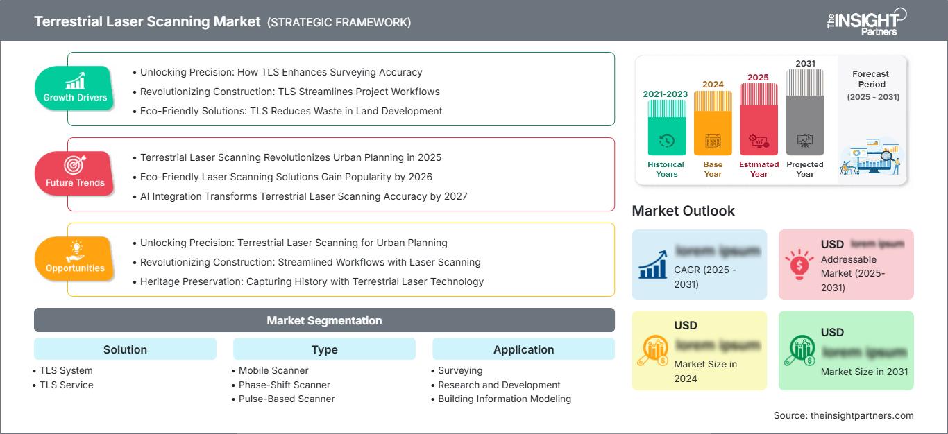
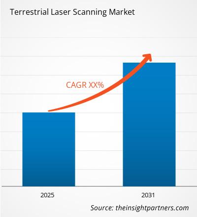
The Terrestrial Laser Scanning Market size was valued at US$ 5.23 Billion in 2025 and is projected to reach US$ 9.42 Billion by 2034; it is expected to record a CAGR of 6.76% from 2026 to 2034. Terrestrial laser scanning converts physical assets into high-density point clouds, supporting accurate surveying, building documentation, research workflows, and model-based project delivery across infrastructure, industrial, and built-environment applications.
The North American market share of the Terrestrial Laser Scanning market will grow by a CAGR of 6.4%-6.9% up to 2034 due to increased investments in reality capture efforts by transportation authorities, utilities, and AEC companies. This will be driven by old infrastructure maintenance, the development of digital twins, and increased BIM applications in projects focused on renovations.
Terrestrial Laser Scanning Market Assessment and Insights
- North America accounted for 29–32% share in 2025 and is growing at a CAGR of 6.4–6.9% between 2026–2034, supported by transport renewal, utility mapping, and digital construction mandates.
- The US represented 73–77% of North America share in 2025 and is growing at a CAGR of 6.5–7.0% between 2026–2034, led by federal infrastructure programs and BIM-led facility management.
- Europe held 25–28% share in 2025 and is growing at a CAGR of 5.9–6.5% between 2026–2034, with Germany, the UK, France, Italy, and Spain advancing rail, industrial, and heritage documentation use cases.
- Asia Pacific captured 30–34% share in 2025 and is growing at a CAGR of 7.2–7.8% between 2026–2034, driven by China, Japan, South Korea, India, and Australia across rail, mining, smart cities, and manufacturing.
- Largest Segment: TLS System held 56–60% market share in 2025 and is growing at a CAGR of 6.1–6.6% between 2026–2034 as hardware remains the primary procurement anchor.
- High Growth Segment: TLS Service held 40–44% market share in 2025 and is growing at a CAGR of 7.2–7.9% between 2026–2034 as outsourcing expands for scan-to-BIM and asset monitoring.
- Key companies analyzed in detail: 3D Digital Corporation, Carl Zeiss Optotechnik GmbH, Creaform Inc., FARO Technologies, Inc., Leica Geosystems AG, Maptek Pty Ltd, RIEGL Laser Measurement Systems GmbH, Teledyne Technologies Incorporated, Trimble Inc., and Zoller + Fröhlich GmbH.
Source: The Insight Partners' analysis based on proprietary research, government publications, company annual reports, investor presentations, industry databases, and expert interviews.
Terrestrial laser scanning market technology development has seen movement towards integration of reality capture systems from stand-alone tripod-based acquisition. Faster cycle times, improved registration processes, and cloud-based processing of point cloud data are revolutionizing the production economics for the surveyor and AEC service provider. The Terrestrial laser scanner manufacture will continue to remain with the precision measurement companies, while software and field services will become more important for customers. The Terrestrial laser scanning market size is thus affected by demand not just for products but for solutions.
Future growth in demand will come from new geographies investing in transport infrastructure, power assets, mining automation, and city resiliency. Safety documentation and asset traceability regulations are increasing the scope of the Terrestrial laser scanning market among public projects and industrial facilities. Funding is being directed towards the integration of scanners with BIM, GIS, robotics, and digital twin technologies for rapid decision-making and quality assurance repeatability.
Terrestrial Laser Scanning Market Report Scope
| Report Attribute | Details |
|---|---|
| Market size in 2025 | US$ 5.23 Billion |
| Market Size by 2034 | US$ 9.42 Billion |
| Global CAGR (2026 - 2034) | 6.76% |
| Historical Data | 2021-2024 |
| Forecast period | 2026-2034 |
Terrestrial Laser Scanning Market Analysis
Demand is being driven by the requirements for capturing built and natural environments efficiently, consistently and accurately. Surveyors employ TLS in order to minimize follow-up visits, while contractors leverage scanning in order to confirm the as-built condition before the installation. The non-contact method of measurement is highly valued by public infrastructure stakeholders since bridges, rail tracks, tunnels, and industrial complexes can be captured while exposing less staff to the field environment.
The value chain involves scanning optics, positioners, registration software, specialized survey teams, cloud hosting, and subsequent modeling. The supply-side dynamics are favorable for companies providing precision hardware along with automated workflows. Terrestrial Laser Scanning market analysis suggests that the service availability will become increasingly important compared to the device availability when the clients require BIM-ready outputs.
The competitive forces are driven by precision measurement firms that have a good channel presence and application software support. The Terrestrial Laser Scanning market report focuses on key companies including Leica Geosystems AG, Trimble Inc., FARO Technologies, Inc., RIEGL Laser Measurement Systems GmbH, and Zoller + Fröhlich GmbH which compete in terms of performance metrics such as speed, range, accuracy, and portability and workflow integration. Creaform Inc. and Carl Zeiss Optotechnik GmbH enhance adjacent industry metrology, while Maptek Pty Ltd and Teledyne Technologies Incorporated handle mining applications and intensive sensing applications.
Trends in investment are focused on automation through software, AI-supported feature extraction, mobile mapping convergence, and processing subscription environments. Positioning is now shifting from sale of devices towards lifecycle data services where the vendors help with repeat scanning, change detection, and performance monitoring of assets. This helps in Terrestrial Laser Scanning market growth by increasing switching costs and integration with enterprise systems.
● REPORT CUSTOMIZATION
Tailor This Report To Align With Your Specific Business Requirements
This report can be customized to align precisely with your business objectives, scope, and target markets. Customization options include tailored segmentation, geography, competitive analysis, and strategic insights to support informed decision-making.
Customize This Report →WHAT YOU CAN ADJUST
- ● Segmentations
- ● Geography
- ● Competitive Analysis
- ● Language Preferences
Terrestrial Laser Scanning Market: Strategic Insights
Regional Insights
North America Terrestrial Laser Scanning
North America held 29–32% share in 2025 and is expected to grow at a 6.4–6.9% CAGR. Infrastructure renewal, brownfield construction, power-grid modernization, and transportation corridor digitization are central adoption drivers. Engineering firms increasingly use terrestrial scans to reconcile legacy drawings with current site conditions before capital work begins.
Procurement is mature because survey contractors, public agencies, and industrial asset owners already understand scanner productivity. The Terrestrial Laser Scanning trends in the region show rising demand for cloud registration, scan-to-BIM delivery, and recurring asset inspection. Utilities and rail operators are also expanding scanning to manage safety, clearance, and maintenance documentation.
U.S. Terrestrial Laser Scanning Market
The US accounted for 73–77% of North America share in 2025 and the Terrestrial Laser Scanning market forecast is expected to register a 6.5–7.0% CAGR. Large transport agencies, federal facility programs, semiconductor plants, data centers, and energy projects use TLS to reduce rework and document complex environments before design, installation, or retrofit work.
Company presence is strong through FARO Technologies, Inc., Trimble Inc., Leica Geosystems AG, and service partners. Application demand is concentrated in surveying, construction verification, Building Information Modeling, public safety documentation, and industrial plant mapping. The country remains a benchmark for enterprise adoption of connected reality-capture workflows.
Europe Terrestrial Laser Scanning Market
Europe represented 25–28% share in 2025 and is projected to expand at a 5.9–6.5% CAGR. Germany is the leading country, supported by rail modernization, industrial automation, automotive plant upgrades, and dense engineering-service capability.
The UK contributes through infrastructure resilience, water assets, tunneling, and retrofit-heavy commercial building programs. Survey firms use TLS for clash prevention, heritage documentation, and construction progress control, particularly where space constraints make manual measurement inefficient.
France, Italy, and Spain add demand from transport corridors, cultural heritage preservation, urban redevelopment, and energy infrastructure. EU digital construction policies and sustainability-oriented renovation programs strengthen scanning adoption, although procurement cycles can be slower than in North America or Asia Pacific.
APAC Terrestrial Laser Scanning Market
APAC held 30–34% share in 2025 and is forecast to grow at a 7.2–7.8% CAGR. China is the leading country, supported by rail, metro, industrial, and smart-city programs.
Japan and South Korea use TLS for manufacturing plants, seismic resilience, and infrastructure inspection, while India expands adoption in metros, highways, energy, and urban development.
Australia contributes through mining, tunneling, utilities, and environmental monitoring. Policy-backed infrastructure investment and faster private construction cycles make APAC the most dynamic regional growth arena.
Middle East & Africa Terrestrial Laser Scanning Market
Middle East & Africa is projected to grow at a 6.8–7.4% CAGR. Saudi Arabia is the leading country as giga-projects, transport networks, and energy assets require accurate site capture.
The UAE applies TLS in high-rise construction, airports, ports, and digital city programs, where rapid project schedules increase reliance on validated as-built data.
South Africa and the Rest of MEA support demand through mining, power, water, and industrial maintenance. Adoption remains service-led, with specialist providers filling capability gaps.
Segmentation Analysis
Solution
The Solution segment is expected to grow at a 6.6–7.2% CAGR from 2026 to 2034. Hardware remains essential for high-precision capture, but services are gaining weight as clients require registered point clouds, BIM-ready models, and recurring monitoring outputs. Procurement decisions increasingly evaluate total workflow productivity rather than scanner specifications alone.
- TLS System remains the largest revenue contributor because scanners, embedded software, tripods, and control accessories form the core purchase for surveyors, AEC teams, mining operators, and industrial measurement users.
- TLS Service demand is scaling as organizations outsource data capture, registration, scan-to-BIM conversion, deformation monitoring, and asset documentation when internal survey capacity or software expertise is limited.
Type
The Type segment is projected to grow at a 6.5–7.1% CAGR from 2026 to 2034. Selection depends on range, accuracy, scan speed, field mobility, and data-processing requirements. Mobile scanners address fast corridor capture, phase-shift models support detailed indoor work, and pulse-based scanners remain important for longer-range infrastructure and terrain applications.
- Mobile Scanner adoption is increasing where crews need rapid data capture across roads, plants, tunnels, mines, and large campuses without repeatedly setting up fixed tripod positions.
- Phase-Shift Scanner products are preferred for high-speed indoor and mid-range capture, especially in commercial buildings, factories, heritage sites, and dense spaces requiring detailed surface geometry.
- Pulse-Based Scanner systems retain strategic importance in longer-range surveying, mining, topographic mapping, and infrastructure inspection where distance performance and outdoor reliability outweigh ultra-fast close-range capture.
Application
The Application segment is expected to grow at a 6.7–7.3% CAGR from 2026 to 2034. Surveying remains the baseline use case, while Building Information Modeling is becoming a strategic demand engine. Research and development applications contribute specialized requirements in deformation studies, environmental monitoring, robotics validation, and scientific documentation.
- Surveying uses TLS for topographic mapping, construction verification, tunnel measurement, industrial layouts, and utility documentation, where speed and complete spatial capture reduce field revisits.
- Research and Development applies TLS in structural health monitoring, landslide studies, forestry, robotics testing, and heritage science, creating demand for precise, repeatable, and well-documented point-cloud datasets.
- Building Information Modeling is expanding rapidly as designers, contractors, and owners convert scans into coordinated models for renovation planning, clash detection, progress validation, and facility handover.
Opportunity Snapshot
| Application | Revenue Contribution | Trend Tag | Adoption Stage |
| Surveying | High | Asset Mapping | Mature |
| Research and Development | Medium | Deformation Study | Scaling |
| Building Information Modeling | High | Scan BIM | Scaling |
Terrestrial Laser Scanning Market Growth Drivers and Impact Analysis
Infrastructure Renewal and Asset Digitization
Older roads, bridges, railways, water infrastructure, and industrial buildings are creating ongoing requirements for baseline documentation that is accurate. With TLS, it is easier for owners to discover deformations, conflicts with clearance, areas at risk of corrosion, and areas that do not adhere to design specifications. The influence on the marketplace will be highest where organizations need to plan for maintenance while the asset is still being used. Scanning enables a reduction in manual measuring as well as greater confidence in design, which leads to less rework and safer working conditions.
BIM Adoption in Renovation and Construction
Building Information Modeling is adding value to scanned data since the owner and construction firms require a confirmed as-is condition prior to design coordination. TLS technology provides details that can be hard to capture by surveyors manually such as voids in ceilings, plant rooms, structural deformities, and congested mechanical areas. The effects are seen in renovations, health care facilities, data centers, airports, and industrial applications where stoppages and changes can cost a lot of money. With BIM moving from visualization to operational handing over, scanner data plays a key role in the record of the facility.
Safety, Productivity, and Non-Contact Measurement
Many of the reasons behind implementing TLS solutions include capturing dangerous, unreachable or time-sensitive environments through fewer man-hours spent at the site. Applications such as mines, tunnels, refineries, bridges and active transportation routes can take advantage of non-contact measurements since this will minimize exposure and will still provide detailed spatial information. Increased productivity is derived from quicker data collection and the fact that this process can be reviewed in virtual space. The business aspect of the solution lies in moving from an intermittent scanning service to a repeated inspection program.
Terrestrial Laser Scanning Market Future Trends
AI-Assisted Point Cloud Interpretation
In future, artificial intelligence shall be used in classification, anomaly detection, feature extraction, and comparison of scans with the design model. This will lower the time needed for the process of analysis that still poses a major challenge in big TLS projects. AI analysis will consistently distinguish between pipes, walls, beams, rails, vegetation, and deformation patterns better than manual tagging only. With advances in technology, competition among providers of the services will be based on the speed of delivery and insights offered, rather than just the process of scanning.
Convergence of Static, Mobile, and Robotic Capture
However, it is highly likely that the line of demarcation between terrestrial, mobile, handheld, and robotic scanners will become increasingly blurred as end-users aim at comprehensive coverage without any disruption in their workflows. While static scanners will play a key role in controlling and capturing scans in a highly accurate manner, mobile solutions and robots will enable faster documentations within corridors, plants, mines, and campus areas. It will also assist in balancing the three aspects of accuracy, comprehensiveness, and speed through integrated data sets. The vendors supporting interoperability are bound to benefit in the long run.
Terrestrial Laser Scanning Market Opportunities
Scan-to-BIM Services for Existing Buildings
Buildings already in existence provide an important business opportunity since their owners usually do not have accurate digital data regarding renovation, regulatory compliance, energy efficiency, and facility management. Service providers may develop repeatable services such as scanning, registration, modeling, and verification to be used in hospital, university, airport, commercial, and industrial campus buildings. The value proposition becomes more evident if one considers how scan-to-BIM helps avoid any design uncertainties and clashes when renovating existing buildings. Service providers who offer combined field acquisition and modeling can become unique players in the services sector.
Mining, Energy, and Industrial Monitoring Programs
There are several advantages related to the implementation of the TLS technology for mines, energy production facilities, and other industrial plants due to their need for accurate information concerning volumes, clearances, deformations, equipment location, and risk factors. Scanning programs will allow gathering similar information during all shifts, maintenance periods, and stoppages instead of conducting surveys once. Service companies and vendors could develop added value through durable equipment, automatic change detection and integration with maintenance systems. The best opportunity exists in situations when stoppage costs much and manual measurements imply difficult working conditions for employees.
Recent Developments
- June 2026: Leica Geosystems AG — introduced the Leica RTC series, positioning the scanners around improved scanning accuracy, productivity, and real-time collaboration workflows for professional reality capture. The launch reinforces demand for faster field-to-deliverable cycles in construction, surveying, and digital twin projects.
- April 2026: FARO INSIGHT, A Business of AMETEK, Inc. today introduces the latest update to its Zone 3D software, delivering new capabilities designed to help public safety professionals work more efficiently, improve analytical confidence, and produce court-ready outputs. As investigations increasingly rely on digital evidence, the ability to quickly transform complex scene data into accurate and understandable insights is critical to delivering objective information to investigators, juries, and judges. The latest Zone 3D update focuses on simplifying this process further by connecting data capture, analysis, and presentation into a single environment.
- February 2025: FARO Technologies, Inc. and Topcon Corporation — signed an agreement to develop and distribute laser scanning solutions, reflecting continued collaboration between measurement technology suppliers to broaden access to integrated scanning workflows. The move supports channel expansion and application coverage across surveying and construction customers.
Frequently Asked Questions

- Comprehensive Market Sizing and Forecast Analysis
- Detailed Segmentation Analysis
- In-Depth Market Dynamics Assessment
- Regional and Country-Level Insights
- Competitive Landscape and Company Benchmarking
- Strategic Business Intelligence
Recent Reports
Testimonials

The Insight Partners' SCADA System Market report is comprehensive, with valuable insights on current trends and future forecasts. The team was highly professional, responsive, and supportive throughout. We are very satisfied and highly recommend their services.
RAN KEDEM Partner, Reali Technologies LTDs
I requested a report on a very specific software market and the team produced the report in a few days. The information was very relevant and well presented. I then requested some changes and additions to the report. The team was again very responsive and I got the final report in less than a week.
JEAN-HERVE JENN Chairman, Future Analytica
We worked with The Insight Partners for an important market study and forecast. They gave us clear insights into opportunities and risks, which helped shape our plans. Their research was easy to use and based on solid data. It helped us make smart, confident decisions. We highly recommend them.
PIYUSH NAGPAL Sr. Vice President, High Beam Global
The Insight Partners delivered insightful, well-structured market research with strong domain expertise. Their team was professional and responsive throughout. The user-friendly website made accessing industry reports seamless. We highly recommend them for reliable, high-quality research services
YUKIHIKO ADACHI CEO, Deep Blue, LLC.
This is the first time I have purchased a market report from The Insight Partners.While I was unsure at first, I visited their web site and felt more comfortable to take the risk and purchase a market report.I am completely satisfied with the quality of the report and customer service. I had several questions and comments with the initial report, but after a couple of dialogs over email with their analyst I believe I have a report that I can use as input to our strategic planning process.Thank you so much for taking the extra time and making this a positive experience.I will definitely recommend your service to others and you will be my first call when we need further market data.
JOHN SUZUKI President and Chief Executive Officer, Board Director, BK Technologies
I wish to appreciate your support and the professionalism you displayed in the course of attending to my request for information regarding to infectious disease IVD market in Nigeria. I appreciate your patience, your guidance, and the fact that you were willing to offer a discount, which eventually made it possible for us to close a deal. I look forward to engaging The Insight Partners in the future, all thanks to the impression you have created in me as a result of this first encounter.
DR CHIJIOKE ONYIA MANAGING DIRECTOR, PineCrest Healthcare Ltd.Reason to Buy
- Informed Decision-Making
- Understanding Market Dynamics
- Competitive Analysis
- Identifying Emerging Markets
- Customer Insights
- Market Forecasts
- Risk Mitigation
- Boosting Operational Efficiency
- Strategic Planning
- Investment Justification
- Tracking Industry Innovations
- Aligning with Regulatory Trends




 Get Free Sample for