
Hydrographic Survey Equipment Market Size, Growth & Demand by 2034
Coverage: By Type (Sensing System, Positioning System, Subsea Sensor, Others); Application (Hydrographic/Bathymetry Survey, Port and Harbor Management, Offshore Oil and Gas Survey, Cable/Pipeline Route Survey, Charting Application, Others); Platform (Surface Vessels, USVS and UUVS, Aircraft); End User (Commercial, Research, Defense); Depth (Shallow Water, Deep Water), and Geography (North America, Europe, Asia Pacific, and South and Central America)
- Status : Data Released
- Report Code : TIPRE00016931
- Category : Electronics and Semiconductor
- No. of Pages : 150
- Available Report Formats :


- Last update date : September 28, 2026


2025 Market Size
US$ 3.05 Bn
Base year value
2034 Forecast
US$ 4.83 Bn
Projected by 2034
CAGR 2026-2034
5.24 %
Growth rate
Addressable Market
US$ 35.75 Bn
(2026-2034)
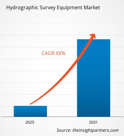
The Hydrographic Survey Equipment Market valued at US$ 3.05 Billion in 2025 is projected to reach US$ 4.83 Billion by 2034, registering a CAGR of 5.24% during 2026–2034. The market includes sensing, positioning, and subsea measurement solutions utilized in various applications such as bathymetric surveying, port management, offshore surveys, navigation, charting, research, and military activities with diversification of the platforms increasingly influencing purchase decisions and deployment tactics.
North America is significant from a structural perspective due to the necessity of hydrographic agencies, defense agencies, offshore companies, and infrastructure managers to have accurate seabed information. The Hydrographic Survey Equipment Market Size is driven by the modernization of survey vessel fleets, autonomous platforms, coastal infrastructure initiatives, and frequent updates of geospatial information.
Hydrographic Survey Equipment Market Assessment and Insights
- North America: North America represented an estimated 33–37% share in 2025 and is projected to grow at a 5.0–5.8% CAGR between 2026–2034, supported by defense surveying, coastal infrastructure renewal, offshore energy activity, and established hydrographic procurement ecosystems.
- US: The US accounted for an estimated 72–78% of North America's 2025 market and is expected to expand at a 5.1–5.9% CAGR between 2026–2034, led by federal surveying, defense, ports, and inland-waterway applications.
- Europe: Europe held an estimated 24–28% share in 2025 and is forecast to grow at a 4.8–5.6% CAGR between 2026–2034, with the UK, Germany, Norway, France, Italy, and Spain supporting demand through maritime infrastructure, charting, environmental monitoring, and offshore activity.
- Asia Pacific: Asia Pacific represented an estimated 25–29% share in 2025 and is projected to expand at a 5.8–6.6% CAGR between 2026–2034, with China, Japan, South Korea, India, and Australia benefiting from port development, naval modernization, offshore projects, and oceanographic programs.
- Largest Segment: Sensing System represented an estimated 42–46% market share in 2025, with a 5.0–5.8% CAGR between 2026–2034, reflecting broad deployment across mapping, navigation, infrastructure, and environmental surveys.
- High Growth Segment: USVS and UUVS represented an estimated 12–16% market share in 2025, with a 7.0–8.0% CAGR between 2026–2034, driven by lower-risk remote surveying and autonomous mission economics.
- Key companies analyzed in detail: Unique Group FZC, Teledyne Marine, SyQwest, Inc., Southern Engineering Co. Ltd. (SECO), Sonardyne Group Ltd., MIND Technology, Inc., Kongsberg Gruppen, iXblue, SONARTRONIC, Xylem Inc.
Source: The Insight Partners' analysis based on proprietary research, government publications, company annual reports, investor presentations, industry databases, and expert interviews.
Hydrographic Survey Equipment market development has shifted from ship-based echo sounding towards sensing systems utilizing multibeam sonars, inertial navigation, acoustic positioning, satellite positioning, computing and automation of the process with autonomous vessels. Miniaturization of sensor hardware makes it possible to install on smaller vessels and undersea platforms, while software solutions allow integration of acquisition, quality control, visualization, and geospatial data generation. International Hydrographic Organization S-100 standard will speed up the development in the direction of interoperable digital hydrographic data.
Further market growth is expected for the equipment capable of working with heterogeneous platforms and producing interoperable data with minimum postprocessing. Development of emerging maritime economies will boost the spending on coastal surveying, port facilities development, offshore infrastructure development, and naval surveying. Regulatory compliance to S-100 data products, including bathymetric surfaces and navigation data sets, will increase demand for high-quality data sources and equipment.
Hydrographic Survey Equipment Market Report Scope
| Report Attribute | Details |
|---|---|
| Market size in 2025 | US$ 3.05 Billion |
| Market Size by 2034 | US$ 4.83 Billion |
| Global CAGR (2026 - 2034) | 5.24% |
| Historical Data | 2021-2024 |
| Forecast period | 2026-2034 |
Hydrographic Survey Equipment Market Analysis
Demand will be influenced by the need to keep up-to-date seabed data for navigation, dredging, construction projects, energy activities offshore, environment, and military needs. Integration of the workflow process and not single pieces of equipment has become more important for market growth because of the demand for integration of positioning, motion correction, depth measurements, imaging, and data analysis. Introduction of the S-100 format increases the importance of interoperability in hydrographic datasets.
Supply chain includes manufacturers of sensors, navigation experts, vehicle manufacturers, software companies, survey contractors, hydrographic offices, military organizations, port authorities, and offshore entities. Supply is affected by precise electronics, acoustic transducers, inertial sensors, waterproof enclosures, and special software. Equipment companies with wide range of products may combine different technologies into a unified product, and specialized companies have to compete with their specific capabilities.
Increasingly, competitive positioning revolves around platforms, autonomy and sensors. Kongsberg Gruppen uses hydroacoustics, positioning and autonomy technologies, and Teledyne Marine leverages its imaging, instrumentation, vehicles and hydrographic software solutions. On the other hand, MIND Technology, Inc. specializes in marine survey products including positioning and towed streamer technology solutions, whereas Xylem Inc. addresses water and hydrographic measurements through its SonTek products.
The Hydrographic Survey Equipment Market trends in investment are towards autonomous survey platforms, small sensors, real-time processing and interoperability. These investments are seen in 2026 technology activities from Teledyne Marine, such as multibeam and autonomous navigation technology, as well as platform-independent subsea sensing and mapping from Kongsberg Gruppen. However, smaller companies like Sonardyne Group Ltd., SyQwest, Inc., iXblue, SONARTRONIC and Southern Engineering Co. Ltd. (SECO) still play a role where there is a need for specialized positioning or acoustic solutions.
● REPORT CUSTOMIZATION
Tailor This Report To Align With Your Specific Business Requirements
This report can be customized to align precisely with your business objectives, scope, and target markets. Customization options include tailored segmentation, geography, competitive analysis, and strategic insights to support informed decision-making.
Customize This Report →WHAT YOU CAN ADJUST
- ● Segmentations
- ● Geography
- ● Competitive Analysis
- ● Language Preferences
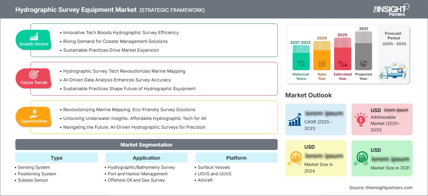
Hydrographic Survey Equipment Market: Strategic Insights
Regional Insights
North America Hydrographic Survey Equipment Market
North America has a 33-37% Hydrographic Survey Equipment Market share in 2025 and is set to experience a 5.0-5.8% compound annual growth rate (CAGR) during 2025-2034. The region enjoys well-developed hydrographic organizations, long coastlines, inland waters, naval needs, and advanced offshore industries. Surveying activities at federal and state levels in the US generate a constant requirement for positioning, bathymetry, acoustic sensing, and data processing equipment.
The US leads regional demand due to its defense surveys, port surveys, dredging operations, coastal resiliency, and marine research. Canada generates additional demand through its Arctic, coastal, fisheries, infrastructure, and navigation surveys. The growing use of autonomous surface and subsea vehicles has created changes in demand due to decreased vessel operating hours and access to harsh environments.
U.S. Hydrographic Survey Equipment Market
The US represented an estimated 72–78% of North America's 2025 demand and is projected to grow at 5.1–5.9% annually through 2034. Federal hydrographic activities, naval surveying, port modernization, dredging, coastal monitoring, and inland-waterway management support recurring equipment requirements. Commercial survey contractors add demand for efficient mobile systems.
According to the Hydrographic Survey Equipment Market Report, Teledyne Marine, Kongsberg Gruppen, Xylem Inc., MIND Technology, Inc., and others contribute to sensors, positioning, autonomous systems, and marine measurements. The focus on applications is moving away from the traditional ship surveys to include USVs, UUVs, fast bathymetry collection, infrastructure surveys, and environmental sensing. There is also federal interest in the purchase of small autonomous surveying and water measuring systems.
Europe Hydrographic Survey Equipment Market
The region was estimated to have a market share of 24%–28% in 2025, and forecast growth until 2034 will be 4.8%–5.6%. Europe is home to a number of centers of hydrography due to its tradition of hydrographic surveying organizations, military needs, ports, offshore energy development, and advanced marine technologies. Germany and Norway offer their contribution to the industry via maritime engineering, ocean technology, military needs, and offshore applications.
France, Italy, and Spain generate additional demands because of their naval projects, ports, coastal management, marine science, and infrastructure surveys. Interoperability of digital hydrographic information and autonomous data collection becomes more and more important for European procurements. Adoption of S-100 is particularly relevant considering that operational standards were introduced in January 2026.
APAC Hydrographic Survey Equipment Market
APAC commanded a share of about 25–29% in 2025 and is anticipated to experience growth of 5.8–6.6% till 2034. China leads the region, with Japan, South Korea, India, and Australia following. Port development, modernization of the navy, offshore activities, and oceanography are some factors that are driving the sales.
Increased industrialization and maritime policies support surveys of the seabed and coastal monitoring. India and Australia hold potential for defense and coastal surveys, whereas China, Japan, and South Korea present the combination of commercial and naval maritime activities together with oceanography.
Middle East & Africa Hydrographic Survey Equipment Market
Middle East and Africa demand is supported by offshore energy, port expansion, coastal development, maritime security, and infrastructure mapping. Saudi Arabia and the UAE are leading regional markets, while South Africa provides an important base for research, ports, and coastal surveying. Rest of MEA remains fragmented.
The projected growth rate for the area is 4.3-5.2%, with the Saudi Arabian region emerging as one of the leading markets. Large coastal and offshore projects need precise information about the seafloor, while defense applications prefer systems that can be deployed autonomously and remotely due to reduced risk factors.
Segmentation Analysis
Type
The Type segment is expected to expand at a 4.9–5.7% CAGR during 2026–2034. Sensing systems retain the largest installed base because bathymetric and seabed measurement remain fundamental requirements. Positioning systems and subsea sensors are gaining strategic importance as survey accuracy, autonomous navigation, and deepwater operations become more demanding. The Hydrographic Survey Equipment Market scope therefore increasingly includes integrated sensor architectures rather than standalone acquisition devices.
- Sensing System: Multibeam and related acoustic sensing technologies remain central to bathymetric acquisition, port surveys, dredging, and seabed characterization. Their integration with real-time processing strengthens operational efficiency.
- Positioning System: High-accuracy GNSS, inertial, acoustic, and hybrid positioning solutions support precise sensor georeferencing. Demand rises as autonomous platforms require reliable navigation where satellite signals are unavailable.
- Subsea Sensor: Pressure-rated and underwater sensing technologies enable deepwater measurement, infrastructure inspection, and environmental surveys. Compact designs improve integration with AUVs, ROVs, and specialized subsea platforms.
Application
The Application segment is projected to record a 5.1–5.9% CAGR during 2026–2034. Hydrographic and bathymetry surveys remain foundational, while port management, offshore infrastructure, cable routing, and charting require increasingly precise datasets. The market analysis indicates that applications are converging around asset lifecycle management, where one survey dataset can support engineering, navigation, inspection, and regulatory needs.
- Hydrographic/Bathymetry Survey: Core mapping activity supports navigation, dredging, coastal engineering, and seabed characterization. High-resolution acquisition is increasingly paired with automated quality control and digital workflows.
- Port and Harbor Management: Ports require frequent seabed updates for dredging, berth planning, navigation safety, and infrastructure monitoring. Compact and autonomous survey systems improve access and operational scheduling.
- Offshore Oil and Gas Survey: Offshore operators use acoustic and positioning technologies for seabed characterization, infrastructure inspection, route planning, and asset integrity, particularly in deeper and more complex environments.
- Cable/Pipeline Route Survey: Accurate bathymetry and subsea positioning are essential for route selection, installation planning, inspection, and maintenance of critical underwater infrastructure.
- Charting Application: Modern chart production increasingly depends on standardized, interoperable digital datasets. S-100 products such as S-101 and S-102 reinforce the importance of structured hydrographic acquisition.
Platform
The Platform segment is expected to grow at a 5.7–6.5% CAGR during 2026–2034. Surface vessels remain important for broad-area surveys, but USVs and UUVs are gaining share because they can operate with reduced crew requirements and improved access. Aircraft complement maritime platforms where shallow-water, coastal, or large-area mapping requires rapid coverage.
- Surface Vessels: Conventional survey vessels remain preferred for deepwater operations, complex sensor payloads, extensive endurance, and projects requiring substantial onboard processing and personnel.
- USVS and UUVS: Autonomous and uncrewed platforms enable repeatable surveys with reduced exposure to hazardous environments. Their compact form factors support shallow, congested, remote, and infrastructure-focused missions.
- Aircraft: Airborne survey platforms provide rapid coverage of extensive coastal and shallow-water areas. They complement acoustic systems where access, water depth, or survey scale limits vessel deployment.
End User
The End User segment is projected to grow at a 5.0–5.8% CAGR during 2026–2034. Commercial organizations account for substantial demand because survey contractors, offshore operators, ports, and infrastructure owners require recurring data. Research institutions and defense organizations sustain specialized demand for advanced sensors, autonomous systems, and high-performance positioning.
- Commercial: Commercial users prioritize productivity, equipment utilization, survey accuracy, and lifecycle economics. Offshore, port, dredging, construction, and infrastructure projects create recurring equipment requirements.
- Research: Research organizations require flexible systems capable of collecting bathymetric, environmental, geological, and oceanographic information across varied water depths and mission conditions.
- Defense: Defense users emphasize resilient positioning, autonomous operation, seabed awareness, infrastructure protection, navigation, and rapid environmental characterization in contested or difficult operating environments.
Opportunity Snapshot
| Application | Revenue Contribution | Trend Tag | Adoption Stage |
| Hydrographic/Bathymetry Survey | High | Seabed Mapping | Mature |
| Port and Harbor Management | High | Port Digitization | Scaling |
| Offshore Oil and Gas Survey | Medium | Deepwater Mapping | Mature |
| Cable/Pipeline Route Survey | Medium | Route Intelligence | Scaling |
| Charting Application | Medium | Digital Charts | Scaling |
Hydrographic Survey Equipment Market Growth Drivers and Impact Analysis
Expansion of autonomous and remotely operated surveying
Autonomous surface and underwater platforms are changing the economics of hydrographic data collection by reducing dependence on large crewed vessels and enabling operations in hazardous or constrained environments. USVs can support repeatable coastal and port surveys, while UUVs can collect detailed seabed information around pipelines, cables, and offshore structures. The commercial impact extends beyond vehicle sales because autonomous deployment increases demand for compact sonars, inertial systems, acoustic positioning, communications, mission software, and onboard processing. Suppliers that design interoperable payloads can address a broader range of platforms. Teledyne Marine and Kongsberg Gruppen are examples of companies expanding autonomous capabilities across navigation, sonar, and vehicle technologies.
Digital hydrographic standards are raising data-quality requirements
The transition toward S-100 based hydrographic products is increasing the importance of data consistency, interoperability, metadata, and processing quality. Operational S-100 product specifications entered into force in January 2026, while the framework now covers products including electronic navigational charts, bathymetric surfaces, water-level information, currents, and under-keel clearance management. This development creates equipment implications because source measurements must support increasingly structured digital workflows. Survey organizations may therefore prioritize sensors and positioning systems capable of higher-quality georeferencing, automated validation, and seamless transfer into production environments. The effect is likely to favor integrated hardware-software portfolios and suppliers capable of maintaining compatibility as specifications evolve.
Growth of subsea infrastructure monitoring requirements
Expansion and aging of offshore infrastructure create a recurring need for seabed mapping, route verification, inspection, and environmental assessment. Subsea cables, pipelines, offshore energy assets, ports, and coastal infrastructure require accurate spatial information before construction and throughout operational life. The market impact is significant because equipment demand becomes linked to inspection cycles rather than one-time project construction. Higher-resolution acoustic systems, electromagnetic sensors, inertial navigation, and autonomous platforms can reduce survey time while improving asset visibility. Recent product developments demonstrate this direction, including Kongsberg's expansion of platform-independent sensing and Teledyne Marine's continued development of subsea multibeam systems.
Hydrographic Survey Equipment Market Future Trends
Platform-agnostic sensor architectures
Future hydrographic systems are likely to become increasingly platform-agnostic, allowing the same sensing technology to move between surface vessels, USVs, UUVs, ROVs, and towed systems. This architecture can reduce equipment duplication and simplify fleet modernization. Vendors will increasingly compete through standardized interfaces, modular pressure-rated housings, compact electronics, and software that automatically adapts acquisition parameters to platform characteristics. Kongsberg's expansion of HISAS beyond its integrated HUGIN ecosystem illustrates this direction, while Teledyne Marine is also broadening autonomous and subsea deployment options. Over time, procurement decisions should increasingly evaluate sensor portability, software compatibility, power efficiency, and lifecycle integration rather than specifications of individual instruments alone.
Real-time processing at the survey edge
Real-time processing is expected to become a defining capability as survey operators seek immediate confirmation of data quality and mission completeness. Edge computing can reduce the need to transfer large raw datasets for initial interpretation, allowing operators to identify gaps, obstacles, anomalies, and infrastructure features while a vehicle remains in the field. GPU-enabled processing, automated gridding, motion compensation, and machine-assisted classification can shorten the period between acquisition and decision-making. Kongsberg's HISAS2020, for example, incorporates real-time processing capabilities, while broader industry development is moving toward integrated acquisition-to-insight workflows. The resulting advantage is not simply faster processing but greater opportunity to modify missions before equipment leaves the survey area.
Hydrographic Survey Equipment Market Opportunities
Integrated packages for smaller autonomous survey fleets
Equipment suppliers have an opportunity in the Hydrographic Survey Equipment Market Forecast to package sonar, positioning, motion sensing, communications, and processing into modular systems designed for smaller autonomous vessels. Such packages can lower integration requirements for survey contractors and infrastructure operators entering uncrewed operations. Commercial offerings should emphasize straightforward installation, low power consumption, automated calibration, remote diagnostics, and compatibility with multiple vehicle types. The opportunity is particularly relevant for ports, coastal authorities, inland waterways, cable operators, and environmental programs where survey areas are extensive but vessel budgets are constrained. Suppliers can also develop recurring software and service revenues around data management, fleet monitoring, quality assurance, and cloud synchronization. This approach would broaden adoption beyond specialized hydrographic contractors.
Regional manufacturing and service ecosystems
Emerging maritime markets offer opportunities for suppliers that combine equipment sales with local integration, calibration, training, maintenance, and technical support. India, Southeast Asia, the Middle East, and parts of Africa are developing ports, offshore infrastructure, research capabilities, and naval fleets that require dependable hydrographic data. Local service capacity can reduce downtime and address the practical difficulty of maintaining precision equipment far from manufacturing centers. Partnerships with shipyards, survey companies, universities, defense organizations, and hydrographic authorities can improve market access while supporting knowledge transfer. Vendors should prioritize ruggedized products, modular spare strategies, regional training centers, and application-specific packages. Such investments can create durable customer relationships without requiring full local manufacturing for every component.
Recent Developments
- July 2026: TGS launched Gemini X, combining its Gemini Enhanced Frequency Source with Apparition encoding technology to enable coordinated multi-source acquisition. The solution is designed to improve seismic data quality, operational efficiency, and imaging for ocean-bottom node exploration.
- November 2024: SOCOTEC acquired Aspect Land & Hydrographic Surveys Ltd., strengthening its specialist surveying capabilities in England and expanding hydrographic, bathymetric, geophysical, and oceanographic services.
- September 2022: EIVA acquired SensorSurvey A/S to strengthen product development and real-world testing of hydrographic survey and subsea inspection solutions through closer collaboration with experienced survey professionals.
- February 2022: Woolpert acquired eTrac Inc., combining vessel-based hydrographic and multibeam sonar expertise with Woolpert’s aerial, bathymetric, and geospatial capabilities to expand integrated marine surveying services.
Frequently Asked Questions

- Comprehensive Market Sizing and Forecast Analysis
- Detailed Segmentation Analysis
- In-Depth Market Dynamics Assessment
- Regional and Country-Level Insights
- Competitive Landscape and Company Benchmarking
- Strategic Business Intelligence
Recent Reports
Testimonials

The Insight Partners' SCADA System Market report is comprehensive, with valuable insights on current trends and future forecasts. The team was highly professional, responsive, and supportive throughout. We are very satisfied and highly recommend their services.
RAN KEDEM Partner, Reali Technologies LTDs
I requested a report on a very specific software market and the team produced the report in a few days. The information was very relevant and well presented. I then requested some changes and additions to the report. The team was again very responsive and I got the final report in less than a week.
JEAN-HERVE JENN Chairman, Future Analytica
We worked with The Insight Partners for an important market study and forecast. They gave us clear insights into opportunities and risks, which helped shape our plans. Their research was easy to use and based on solid data. It helped us make smart, confident decisions. We highly recommend them.
PIYUSH NAGPAL Sr. Vice President, High Beam Global
The Insight Partners delivered insightful, well-structured market research with strong domain expertise. Their team was professional and responsive throughout. The user-friendly website made accessing industry reports seamless. We highly recommend them for reliable, high-quality research services
YUKIHIKO ADACHI CEO, Deep Blue, LLC.
This is the first time I have purchased a market report from The Insight Partners.While I was unsure at first, I visited their web site and felt more comfortable to take the risk and purchase a market report.I am completely satisfied with the quality of the report and customer service. I had several questions and comments with the initial report, but after a couple of dialogs over email with their analyst I believe I have a report that I can use as input to our strategic planning process.Thank you so much for taking the extra time and making this a positive experience.I will definitely recommend your service to others and you will be my first call when we need further market data.
JOHN SUZUKI President and Chief Executive Officer, Board Director, BK Technologies
I wish to appreciate your support and the professionalism you displayed in the course of attending to my request for information regarding to infectious disease IVD market in Nigeria. I appreciate your patience, your guidance, and the fact that you were willing to offer a discount, which eventually made it possible for us to close a deal. I look forward to engaging The Insight Partners in the future, all thanks to the impression you have created in me as a result of this first encounter.
DR CHIJIOKE ONYIA MANAGING DIRECTOR, PineCrest Healthcare Ltd.Reason to Buy
- Informed Decision-Making
- Understanding Market Dynamics
- Competitive Analysis
- Identifying Emerging Markets
- Customer Insights
- Market Forecasts
- Risk Mitigation
- Boosting Operational Efficiency
- Strategic Planning
- Investment Justification
- Tracking Industry Innovations
- Aligning with Regulatory Trends




 Get Free Sample for